
 On Sunday, October 16, 2011 we embark on hike number 10. This is going to be a long one of 15.5 miles. We begin at 8:00 am on a beautiful day with the temperature in the upper 60's. It quickly warms and we progress reaching a high of 89 degrees according to my car's external temperature gauge.
The first mile leads us through fields that have been clear-cut a couple of years ago. The terrain is sandy with lots of 10-12 foot pines and scrub oak. At 1.2 miles we cross Red Doe Creek and are now hiking in a pleasant pine forest. At 2.3 miles we arrive at Forgotten Creek Campsite. We are making great time.

At 2.7 miles we cross Lafayette Creek, at 3.6 miles we cross Little Black Creek and at 4.7 miles we cross Black Creek. all of these crossing are made on nice small timber spans of the water.

It is in this region we run into a problem. We cross a sandy road and begin to see recent clear-cutting activity. the clear cutters have had no regard for the trail and have cut and cleared most of the blazed trees. The pine boughs cover the trail and navigation becomes very difficult.
 We spend 30 minutes searching for the next blazes to lead us on before finding them several hundred yards away from the last blaze. If I were hiking this by myself I might have spent several hours searching instead of 30 minutes. So much for the fast pace.
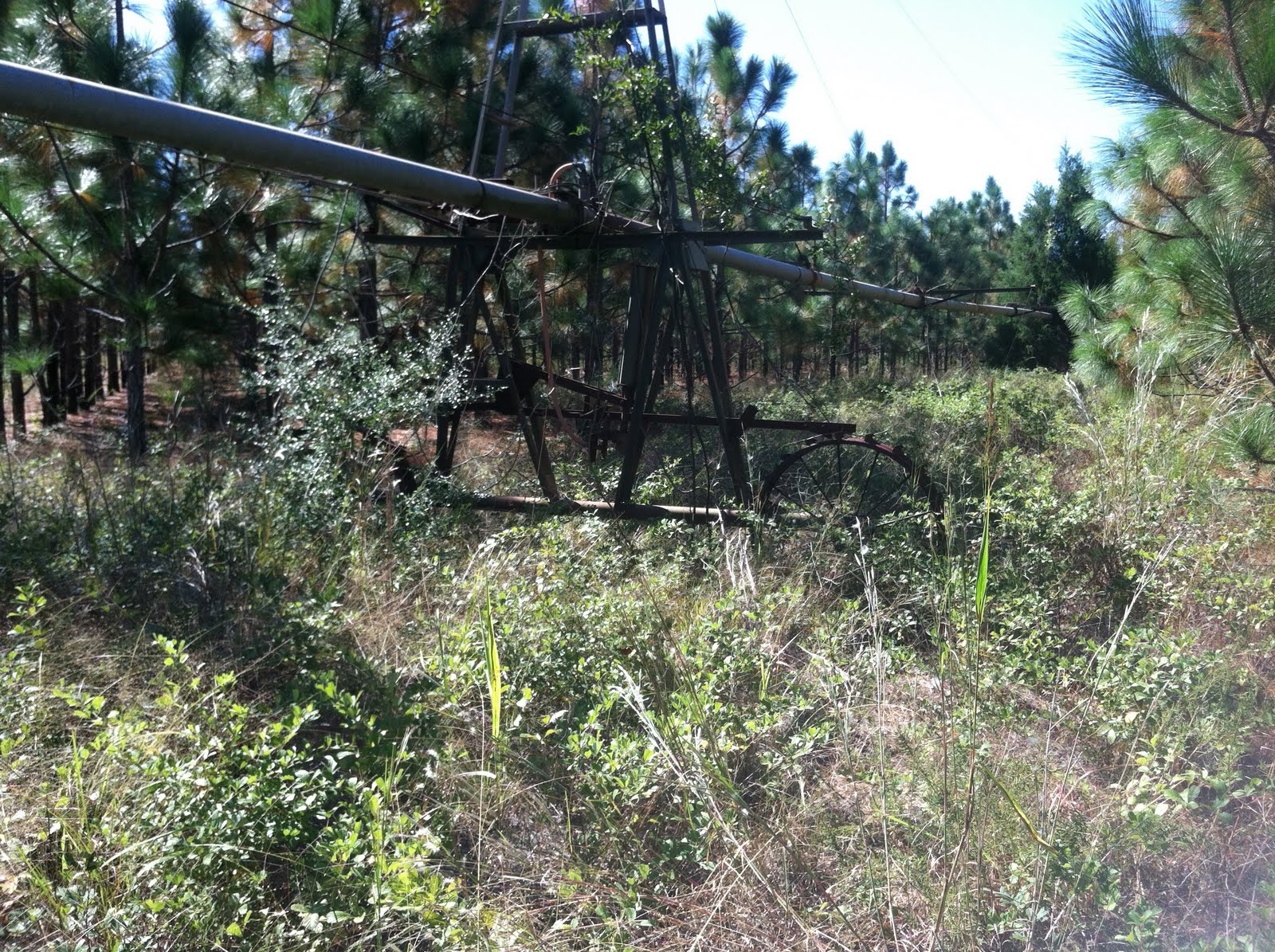
At 6.4 miles we cross Golf Course Road (no sign of a golf course) and find a new type of sign marking the trail. At 7.4 miles, after a very pleasant mile long hike through a pine forest with a floor covered in fresh pine needles we pass an old sprinkler from a former sod farm that operated many years ago.
 We pass a second on at 7.9 miles and then come across a very interesting concrete pit in the middle of the woods. Years ago this section was a cattle farm and the pit was a Tick Bath for the cattle.
  It is about 30 feet long, 4 feet deep, and just wide enough for cattle to parade through one at a time. In its day, it was filled with a solution that caused the ticks to release their grip on the cattle. It is empty now, but I wonder what years of holding the toxic liquid has done to the surrounding area.
 At 8.8 miles we cross an unnamed creek and it is a short 1.2 miles to the intersection of the trail with Hwy. 81. At this point we have a 5.5 mile hike south along the side of the road. The amount of litter on the roadway, especially empty beer cans/bottles is bothersome. Clearly the local ethic doesn't value keeping the area looking nice. We also pass an interesting sign telling us to "keep the hell out". I guess this is to be expected. The funny thing is not so much the language as the fact that this hand-painted sign is no more than 15 feet from a much more formal one. Redundancy is needed in this neck of the woods...
We arrive at the car at about 1:35 pm having hiked the official 15.5 miles, plus an extra mile trying to find our way through the clear cut. We've averaged over 3 miles per hour and feel worn, but good, about the effort.
No comments:
Post a Comment